- Menu
-

-
Camping
-
Knives and Defense
-
Gear and Wear
-
Optics and Electronics
-
Hunting and Fishing
-
Eating and Cooking
- Misc.
Customer Service
Products!
Payments
Within 24H/48H
 View larger

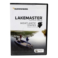
MID ATLANTIC STATES PLUS HUMMINBIRD
Mid Atlantic States
The MidAtlantic States PLUS, Version 2.0 map card has many standard and high definition lake maps for Delaware, Maryland, North Carolina, South Carolina, Virginia, West Virginia. The PLUS series allows for aerial images to overlay onto high definition waters, in addition to existing LakeMaster features.
Now you have the ability to use quality aerial photography to view the entry and exits of creek channels, see how far a reef or weed line extends, and pick out shallow - water rock piles, steep drop-offs or other features of the lake you've been missing from traditional maps.
Features:
- Aerial Only
- Aerial + LakeMaster Contours
- Aerial + Contours Only
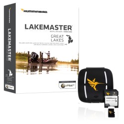
Includes:
- Micro card with SD adapter
- Waterproof carrying case
Specifications:
- Compatible with iPilot
- States Covered: Delaware, Maryland, North Carolina, South Carolina, Virginia, West Virginia
HUMMINBIRD.600043-4
082324050039

30 other products in the same category: Navigation and Accessories
-
CONTOUR ELITE- GREAT LAKES HUMMINBIRD
$148.95 $149.95
-
CONTOUR ELITE- MIDSOUTH STATES HUMMINBIRD
$148.95 $149.95
-
Navionics Update World NAVIONICS
$128.00 $129.00
-

Navionics Update NAVIONICS
$98.00 $99.00
-
Navionics+ World NAVIONICS
$248.00 $249.00
-

Navionics+ NAVIONICS
$198.00 $199.00
-

HotMaps Platinum Canada NAVIONICS
$198.00 $199.00
-
HotMaps Platinum West NAVIONICS
$198.00 $199.00
-
HotMaps Platinum East NAVIONICS
$198.00 $199.00
-

HotMaps Platinum South NAVIONICS
$198.00 $199.00
-

HotMaps Platinum North NAVIONICS
$198.00 $199.00
-

AS GRP Precision GPS Receiver HUMMINBIRD
$148.99 $149.99
-
AS GPS HS Precision GPS Receiver w/Headng HUMMINBIRD
$198.99 $199.99
-
SMARTSTRIKE - GREAT LAKES HUMMINBIRD
$198.99 $199.99
-
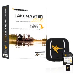
GREAT LAKES PLUS HUMMINBIRD
$148.99 $149.99
-
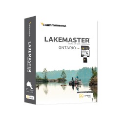
ONTARIO HUMMINBIRD
$123.99 $124.99
-
GREAT LAKES HUMMINBIRD
$123.99 $124.99
-
HB SATVIEW - LOUISANA DELTA HUMMINBIRD
$148.99 $149.99
-
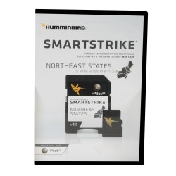
SMARTSTRIKE - NORTHEAST STATES HUMMINBIRD
$198.99 $199.99
-
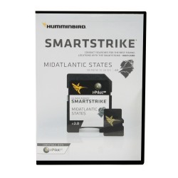
SMARTSTRIKE MID ATLANTIC STATES HUMMINBIRD
$198.99 $199.99
-
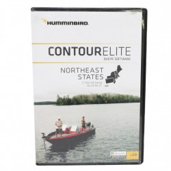
CONTOUR ELITE- NORTHEAST STATES HUMMINBIRD
$148.99 $149.99
-
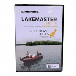
NORTHEAST STATES PLUS HUMMINBIRD
$148.99 $149.99
-
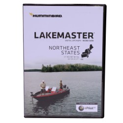
NORTHEAST STATES HUMMINBIRD
$123.99 $124.99
-
MID ATLANTIC STATES HUMMINBIRD
$123.99 $124.99
-
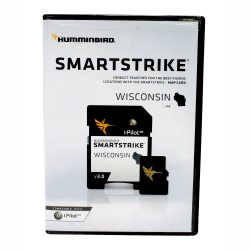
SMARTSTRIKE - WISCONSIN HUMMINBIRD
$198.99 $199.99
-
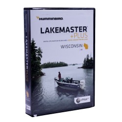
WISCONSIN PLUS HUMMINBIRD
$148.99 $149.99
-
WISCONSIN HUMMINBIRD
$123.99 $124.99
-
SMARTSTRIKE - GREAT PLAINS HUMMINBIRD
$198.99 $199.99
-
WOODS/RAINY PLUS HUMMINBIRD
$148.99 $149.99
-
GREAT PLAINS PLUS HUMMINBIRD
$148.99 $149.99